Water Quality Matters
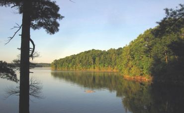
Good lake water quality matters because it supports life - fish, birds, and plants depend on it, as do the people who swim, fish and gather along its shores.
Clean water protects ecosystems, preserves property values and ensures that lakes remain places of beauty, recreation and connection for generations to come.

Unleash Your Inner Explorer: Wolfe lake Parks in Pictures
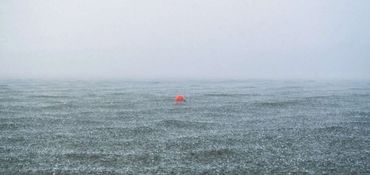

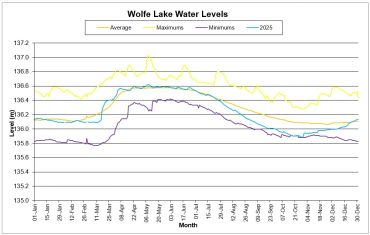
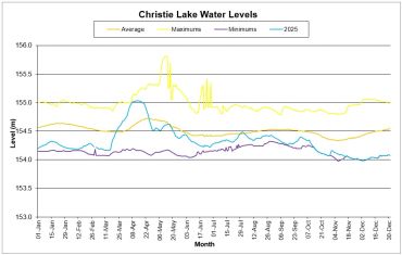
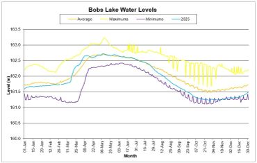
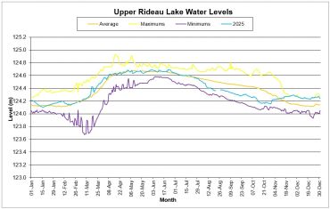
SEASONAL WATER LEVELS
Additional Information
Wolfe Lake water levels slowly and sometimes drastically decrease throughout the summer and fall. These decreases are due to a combination of evaporation and the release of water to maintain navigable water levels on the Rideau Canal. Water is released through the dam located on the southeastern shore of Wolfe Lake. At the nearby boat launch automated equipment measures and transmits water level data to a central site.
Six water level stations are found throughout the watershed along the Rideau River and on Big Rideau, Bobs, Wolfe and Upper Rideau Lakes. Data is collected using electronic continuous recording units. A sensor reads the water levels usually at one hour intervals and that data is recorded in a “data-logger” that can be downloaded at the site or transmitted to the Rideau Valley Conservation Authority (RVCA) by telephone, radio or satellite communication.
Interactive Water Level Graphs
RVCA's interactive graphs show water level data measured at several locations on the Rideau River system.
Parks Canada 2025 Water Levels Reports - Wolfe, Christie, Bobs & Upper Rideau